Earlier this month, I
wrote about my trip to Portsmouth where I hired a water taxi to see some of the large sailing vessels in Prince Rupert Bay that weekend. Being on the water and seeing the three tall ships and all those yachts made me interested to try something like that while I'm down here in beautiful Dominica.
As it turns out, I learned about a local yacht that sometimes does charters from Portsmouth. It is a 40.5 foot Hunter Legend sailboat named the “Sophia K.” (the picture below—taken by a drone—is from the “Sail with Sophia Charters” Facebook page). Yesterday, I was able to join a group for an outing up the northwestern coast of Dominica. It was fantastic!
A small inflatable dingy was used to transport us from the shore to the boat. Once everyone was on board, we headed out to sea. Soon the engine was silenced and the sail was unfurled. We were riding the wind.
It wasn't long before we were passing the twin hills of
the Cabrits National Park—a place I have often visited but had never viewed from this vantage point, bobbing on the deep blue water of the Caribbean as the steady wind drove us northward. The photo below shows the two hills that jut out from the mainland on the left, with Purple Turtle Beach visible in the distance towards the right side. If you look close towards the left, between the twin hills you can see a couple of the restored fort buildings and their orange-tiled roofs amidst all the lush, green forests of the Cabrits National Park. If you look real hard towards the right, you can see the masts of some of the many yachts anchored off Purple Turtle Beach.

We moved along at a moderate pace, past the Cabrits peninsula that separates Prince Rupert Bay from Douglas Bay. I enjoyed watching other boats enjoying the beautiful day on the water, including the fast sailboat pictured below which passed us on the outside (notice that there is yet another sailboat in the distance on the left). The colorful Dominican national flag is also visible as it fluttered in the wind off our stern (note to self: I should have checked my photos because I thought I had successfully captured the flag stretched out fully behind us, but it apparently had just whipped around the staff for a moment when the shutter opened).
Eventually we were passing Capuchin on the northwest corner of the island. The picture below gives you an idea of the rugged terrain here on the Nature Island. Note, too, that another sailboat can be seen near the coast on the left half of the picture.
We continued sailing into the channel that separates Dominica from the French island of Guadeloupe. It was around this time that I took an interest in the instrumentation in front of the captain. It included a depth finder, that indicated the sea floor was over 2600 feet below (about a half a mile). Then we turned around and headed back. The picture below shows our dingy trailing us in the channel. With closer examination, you might be able to pick out the hazy view of the island of Guadeloupe in the distance (look underneath the whitest of the clouds that form a line above the horizon).
Rather than going straight back, we detoured into Toucarie Bay—
a beautiful place that I've written about before. We anchored in the middle of the bay to let folks swim for awhile. I had brought my mask and snorkel with me, so I went exploring. I got to see a lot of incredible views, but most of the fish (parrot fish, angel fish, sargent majors, etc.) were ones I had already seen in other places (check out
this story for pictures). That is not a complaint, because it was still fantastic to see all the underwater life!
However, the most memorable aspect of this snorkeling experience was the huge school of fish that surrounded me at one point. I'm not sure what kind they were because they were rather non-descript silver colored fish, the largest of which were probably6 to 8 inches long. It seemed as if there were thousands of them, swimming all around me, darting in unison from one direction to the other. I thought it would only last for a short while, but this “fish storm” lasted for several minutes. It was almost disorienting as they whizzed back and forth. None of them touched me, but they didn't seem scared of me and stayed quite close. Since I don't have an underwater camera, I have no proof of this phenomenon, but below is a diagonal picture I took from the boat showing the north side of Toucarie Bay (the Catholic church with its steeple can be seen towards the right).

Eventually, we gathered on board again, ate some of the food everyone brought, and then headed out of Toucarie Bay. The picture below shows our dingy trailing behind us as we passed by Douglas Bay, on the north side of the Cabrits peninsula. Again, note the mountains in the background.
We cut close the shoreline as we passed the end of Cabrits, as shown in the photo below. The distant shoreline of the Capuchin area can be seen towards the left side. High atop this steep hill is a remaining cannon from the days when France and Britain fought over this island.
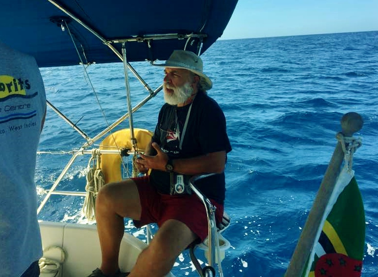
After more than five hours (from before 10AM to after 3PM), we finally returned to where we had started. It was well worth the $100 EC (about $40 US dollars) that I paid. The dingy ferried us back to shore after a fun day with new friends, one of whom shared this picture with me.
I wasn't sure what it was going to be like to board a small sailing vessel for most of a day with a bunch of strangers, but it turned out to be a great time. We had lots of good conversations, and found many common areas of interest. One woman had even lived in a log cabin at
Fort New Salem in West Virginia for a year—who would have thought I'd meet a Fort New Salem resident in the Caribbean? It just goes to show what a small world we live in!


No comments:
Post a Comment